

What data do we use?
The project has been interested in exploring the mechanisms of linking & clustering historic data using geography & time, generating derived information and knowledge set in the present world which can be used for non-commercial purposed.
As a result we are using lots of different types of data - linking them together using the geographical location.
List of data used in the project:
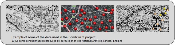
- Raster Maps of Aggregate Night Time Bomb Census 7th October 1940 to 6 June 1941
- Raster Maps of Weekly Bomb Census for 7th to 14th October 1940
- Bomb locations for aggregate Night Time Bomb Census 7th October 1940 to 6 June 1941
- Bomb locations for Weekly Bomb Census for 7th to 14th October 1940
- 24 hours of Blitz Sept 7th 1940
- Defences of Britain showing Anti-invasion defence locations
- Imperial War Museum Images
- BBC history WW2 memories
- Present day street map tiles
- Present day aerial imagery
Click here for more information on the individual data sources and their copyright.


